Trailguide 2025 Edition
 Bjørn Jarle Kvande, 8. April 2025
Over the winter of 2025 Trailguide has had a major overhaul of the internals, improvements to the user interface, removal of some features, and some new ones has been added.
Mountain biking only
Trailguide now only has content for mountain biking, and future development of the app will solely focus on making the best possible app for mountain biking, and how to give you the best possible experience on your bike.
New user interface
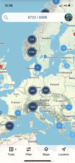
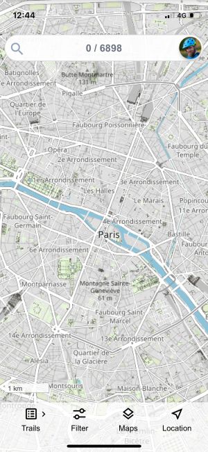
After carefully inspecting how the app is being used, the bottom menu was redesigned to make it easier for you to reach the various features of the app.
The map layer selector was moved from the top of the screen down to the bottom and into the menu.
The slider to make map overlays transparent was removed, but the same effect can now easily be accomplished by toggling map layers on and off.
Instead of having two different navigation modes, we now have one, a live navigation mode that follows you around. To turn it off, you simply click the location indicator.
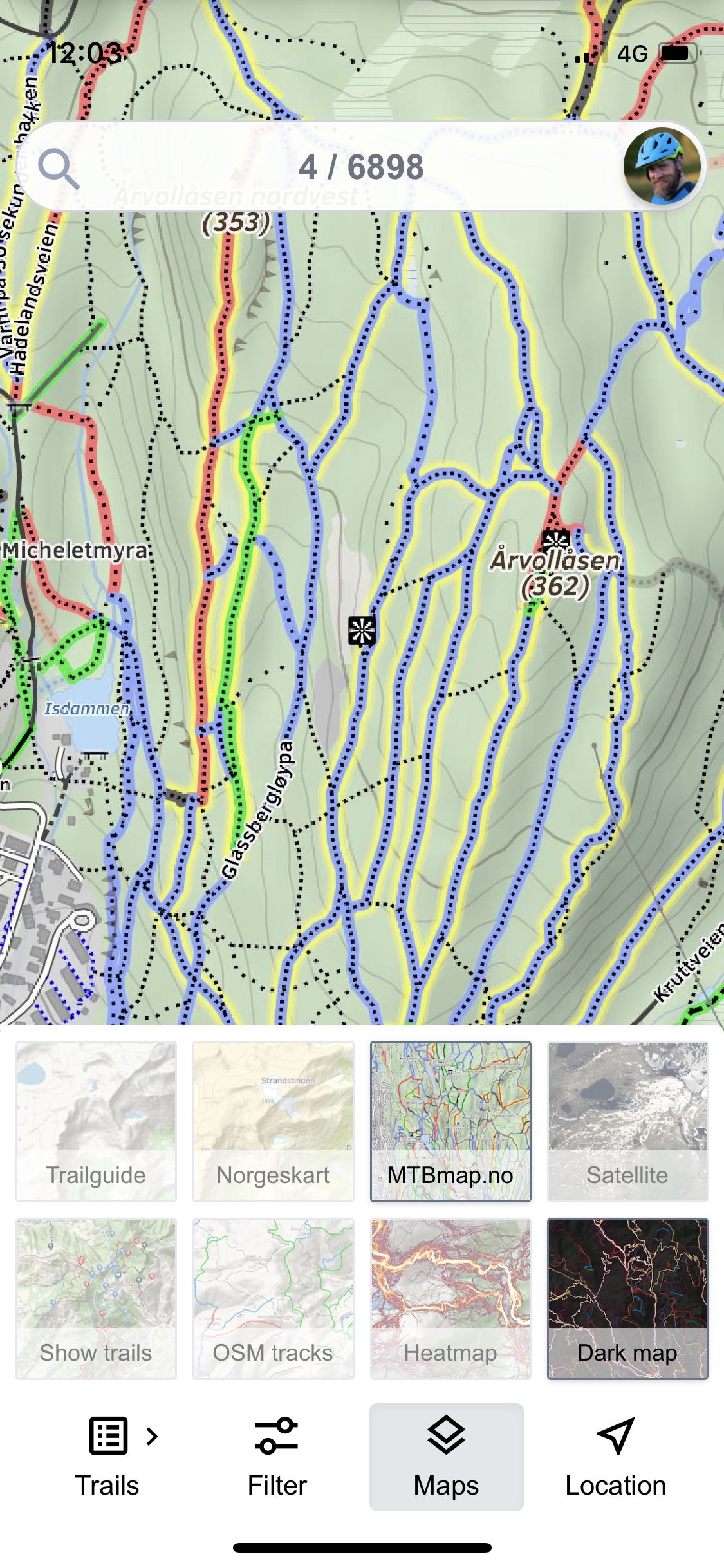
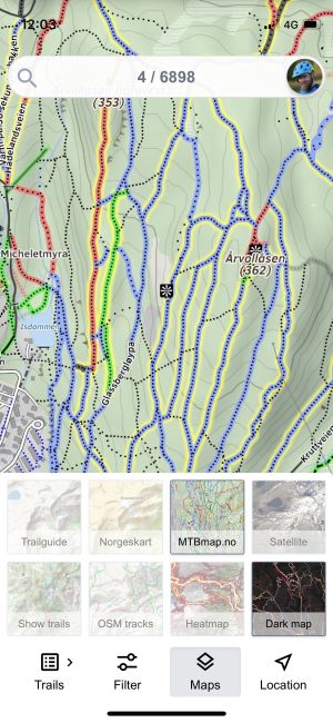
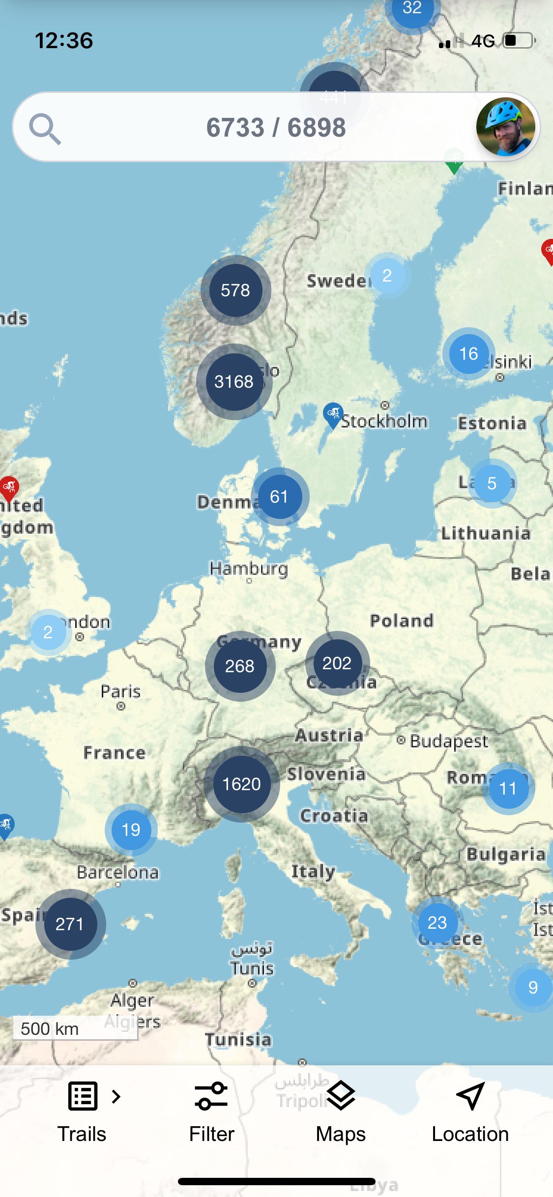
Map layers
The map layer selector was moved from the top of the app screen down to the bottom menu so it is easily reachable with one hand.
Using the map selector you can choose which base map you prefer, and display various map layers to help you find trails and guide you on your ride.
There is also a dark mode available for the map. This is especially helpful if you have your phone on the handle bars for live guiding.
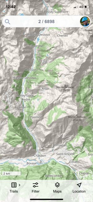
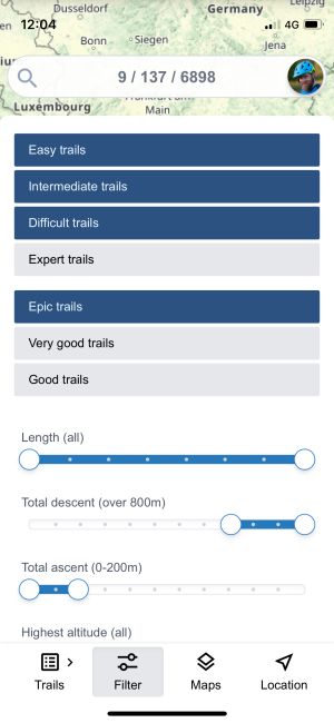
Trail filters
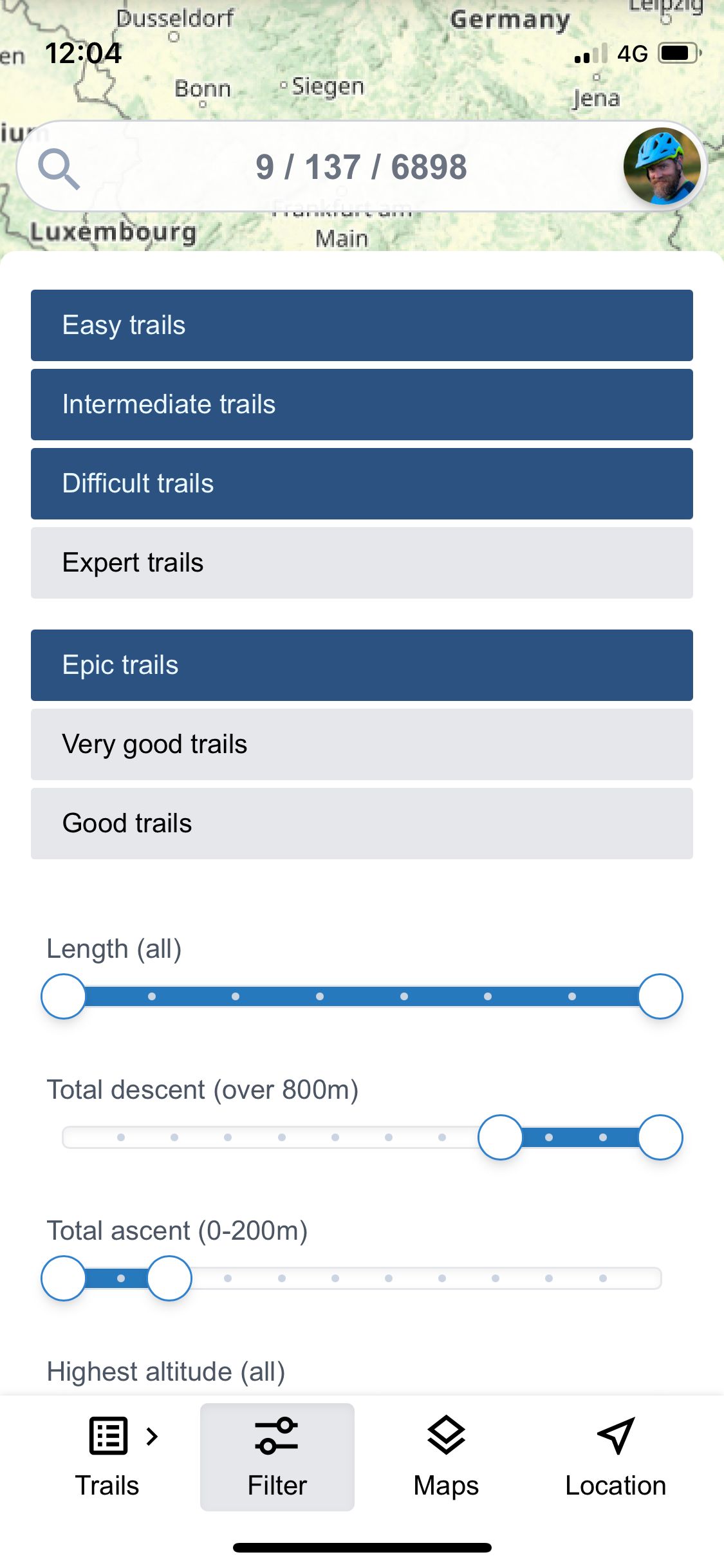
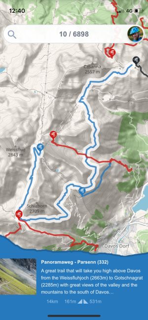
To find trails suitable to your riding ability and style, you can now activate a filter which fill show you a subset of all trails in the app.
If you prefer epic trails with long descents starting at high altitude, you can now easily set the filter to show you only those trails.
Filter by difficulty, length, total ascent and descent, and altitudude.
Show only trails others have rated epic or very good.
You can even show trails that are accessible by car or ski lifts, or trails that are suitable to ride in bad weather is this is the only type of weather you have.
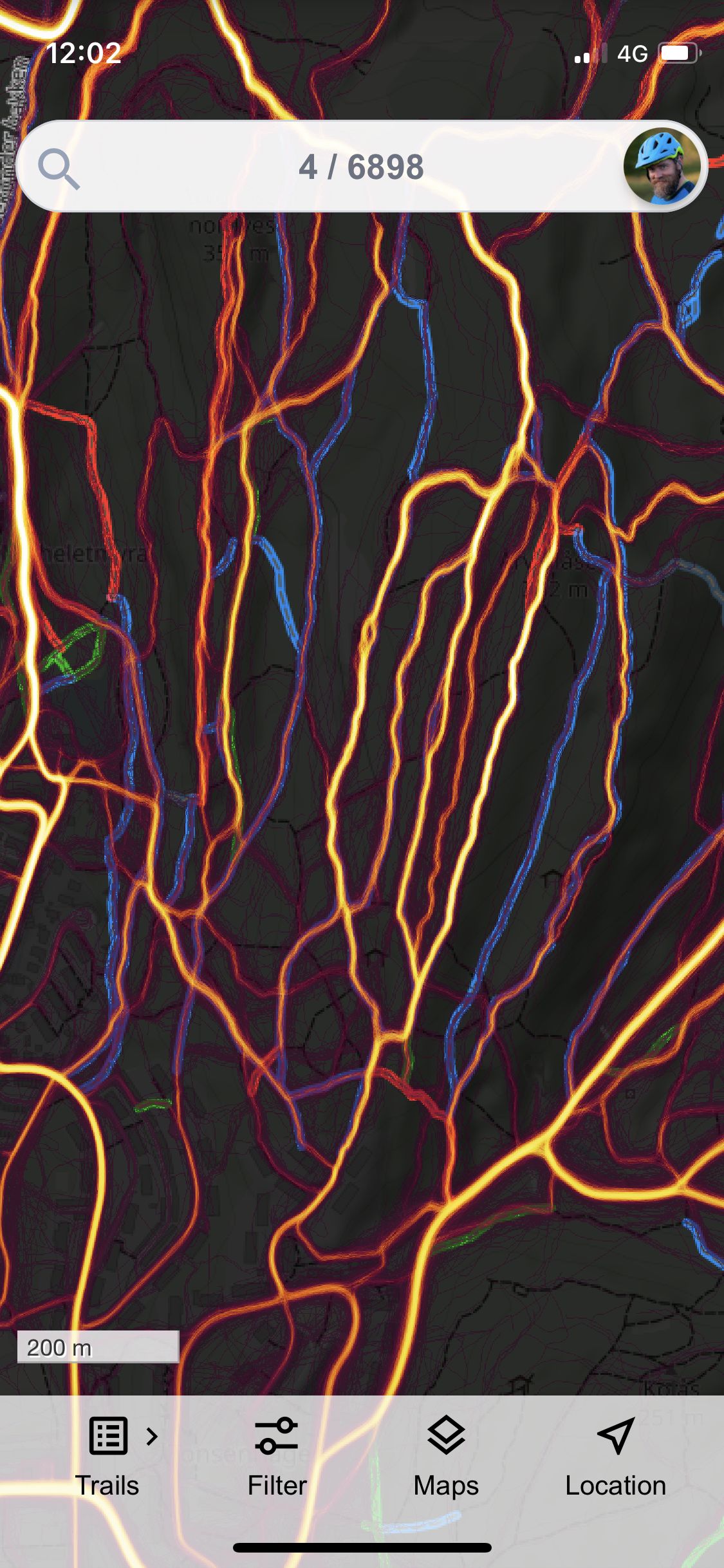
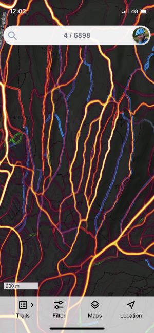
Dark mode
If you are one of those who prefer to have your phone on the handle bars for live navigation, you can now use dark mode for the map.
If you combine this with highlighting the trail you are following or turning on the heat map, following the track will now be much easier.
Dark mode can be activated from the map layer selector in the bottom menu.
Maybe it uses less battery also?
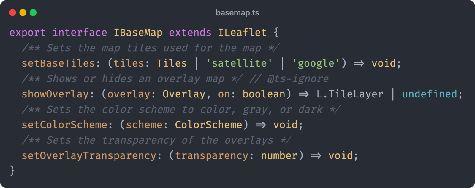
Major overhaul of the internals
Any large software project like Trailguide is in constant danger of becoming too complex and one has to take care not to let the code base grow out of control.
This winter, the entire codebase was rewritten from JavaScript to TypeScript, to make it easier to catch any bugs, and harder to make new ones.
Having static analysis of the code using TypeScript combined with a huge set of automated tests, ensures I can always make small and large changes to the code base without worrying about breaking anything.
What all this means is that I can add new features much faster and continue evolving the app for years to come.