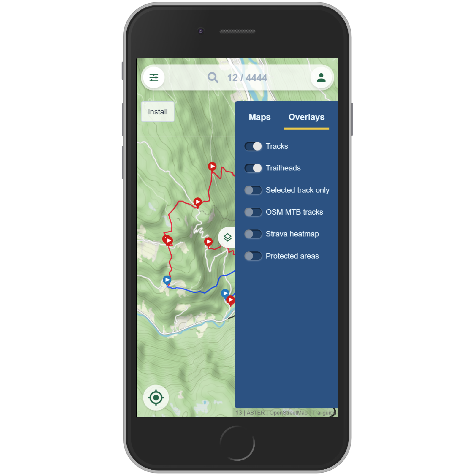
Overlays
Open the map selector and switch to the "Overlays" tab.
By default the tracks and trailheads are activated. Deactivate them to see no content on top of the base map.
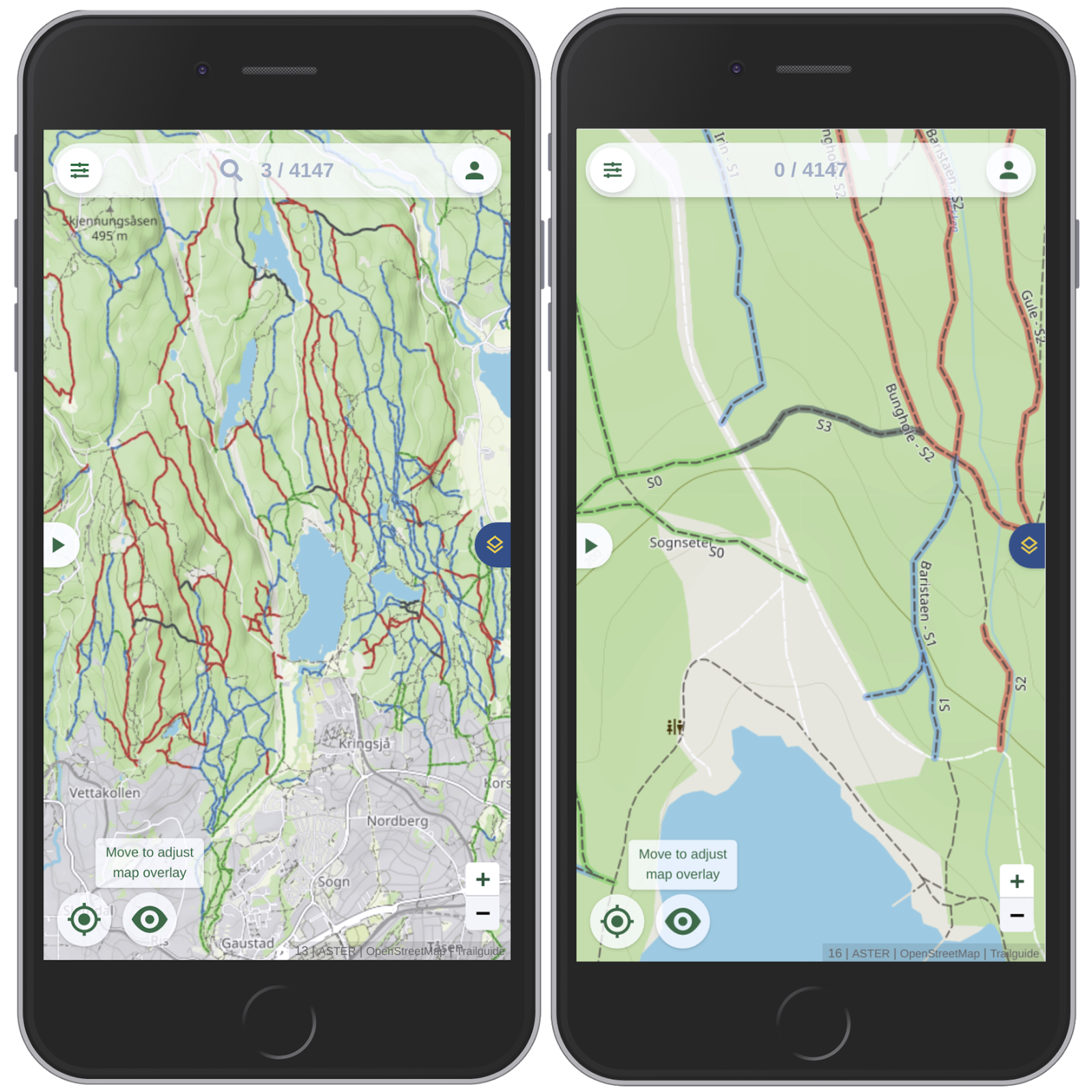
OSM MTB tracks
Get access to over 300.000 mountain bike tracks worldwide by activating the "OSM MTB tracks" overlay.
"OSM" stands for OpenStreetMap, a huge mapping project with more than 6 million contributors worldwide.
The overlay shows singletracks (no gravel or paved roads!) that are ridable with the mountain bike. The color code is the same as for the Trailguide tracks from green (very easy) to black (very difficult).
Zoom in to see the difficulty rating of the Singletrail Skala (S0 to S5) and the trail names.
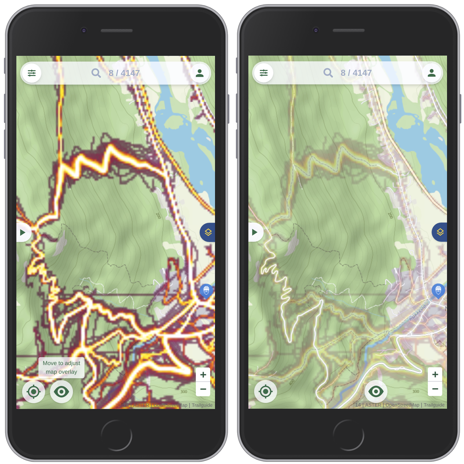
Strava heatmap
The strava heatmap shows the traffic intensity on the map. The brighter and wider the lines, the more traffic. It is biking only data!
Use it to explore new areas, see where other bikers ride and if there's traffic on a trail. It makes it easy to find a suitable uphill to a trail you want to ride down.
When you activate an overlay, a button with an eye shows up. Move this button right or up to adjust the transparency of the overlay making it easy to see what is underneath the overlay.
Due to restrictions we can not use a very high quality and you will see some pixels. For our purposes it works very well though.
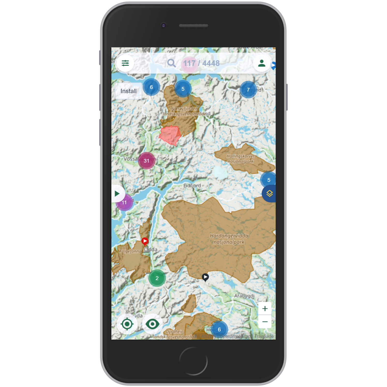
Protected areas
The protected areas overlay shows nature reserves (brown), restricted military zones (red) and other restricted areas.
Not all types of protected areas restrict the access. So make sure you do more research. But it helps you to easily see if your planned tour will go through a protected area.
If you have selected an overlay option, the layer icon turns blue to indicate active changes. The settings are retained if closing and restarting.
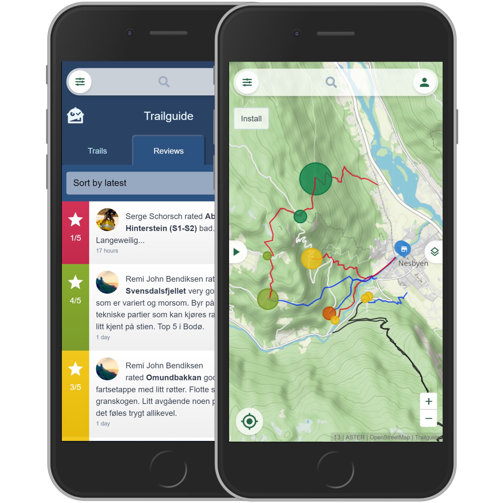
Show reviews on the map
When the "Reviews" tab is activated (in the list, not in the map selector), the reviews are shown on the map. Find out more about the reviews tab here. Close the list to get back to the map by clicking on the "x" button at the top right.
Now you see circles on each trail head. The color indicates the average rating, the diameter represents the number of reviews.
Click on a circle to see the individual reviews.